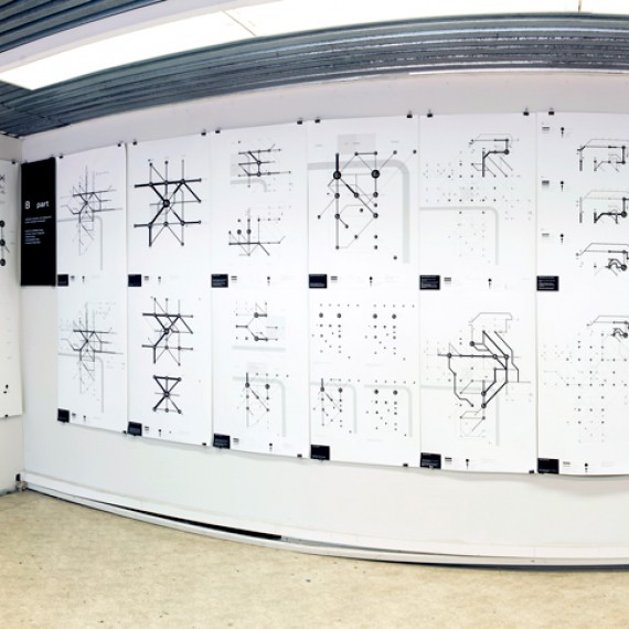
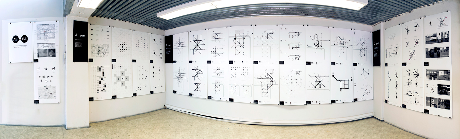
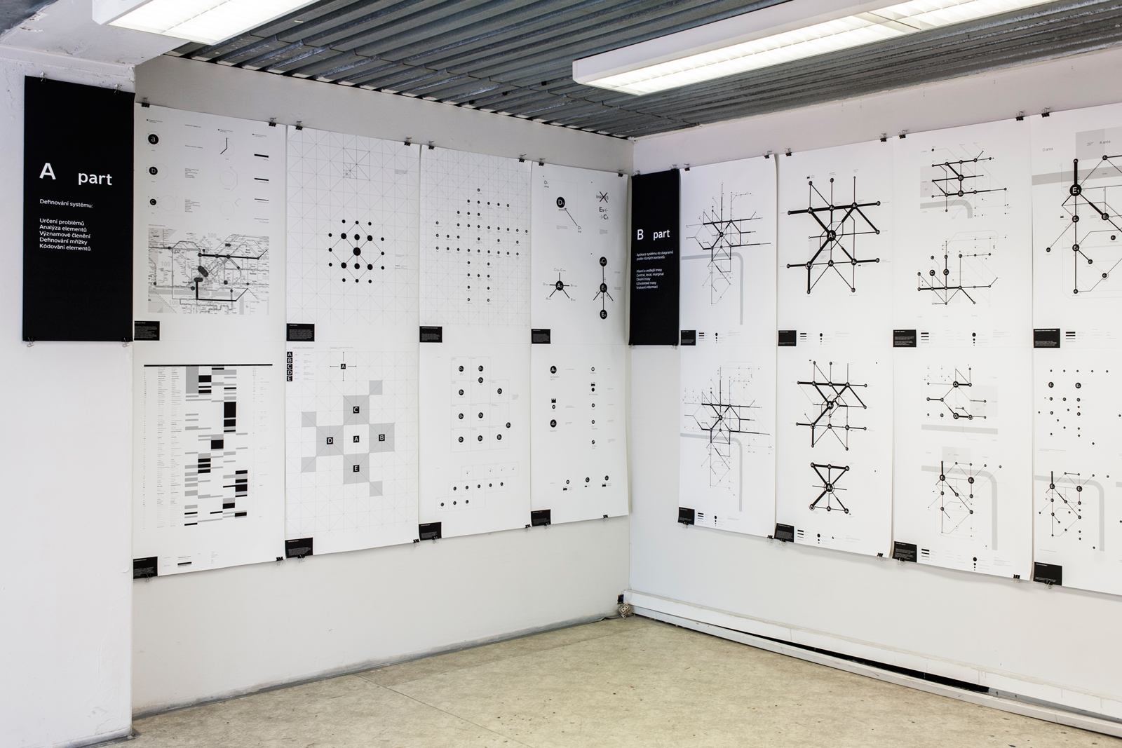
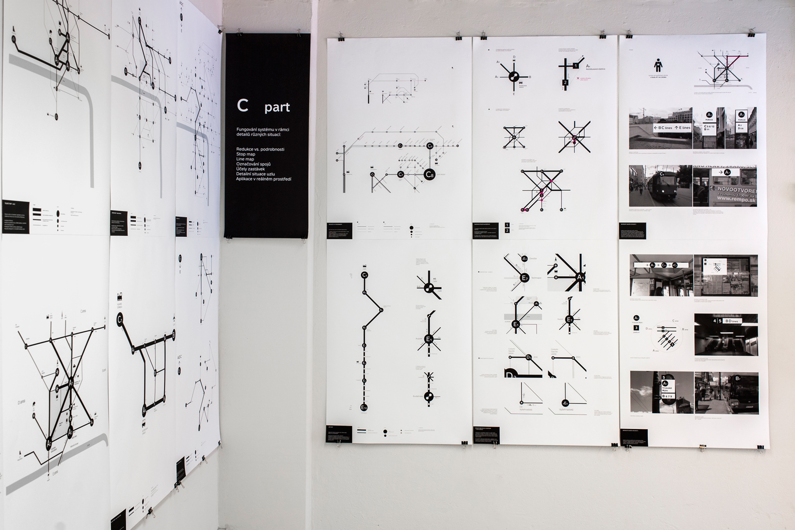
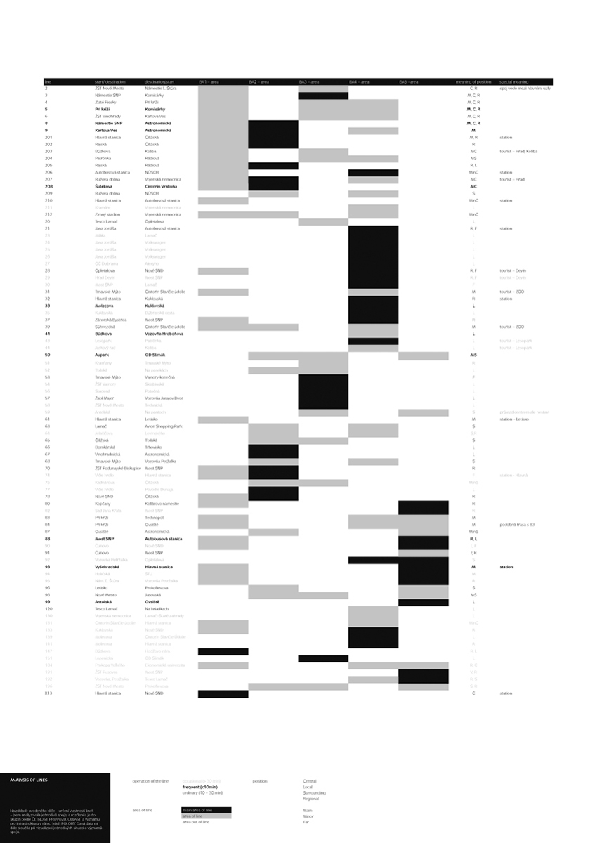
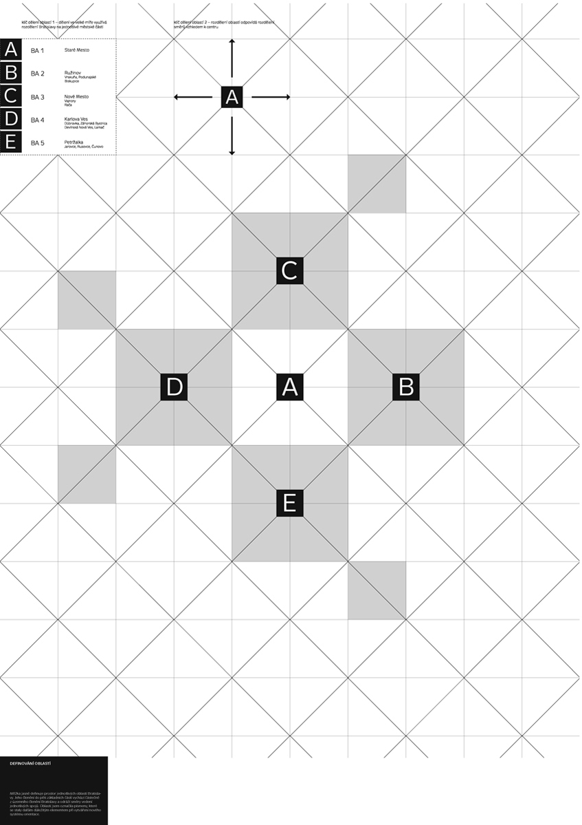
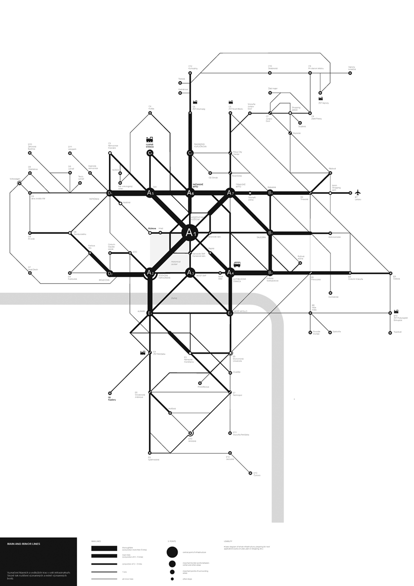
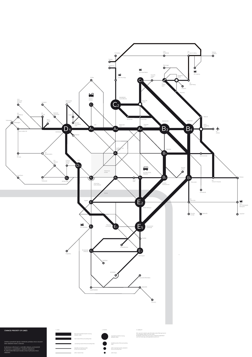
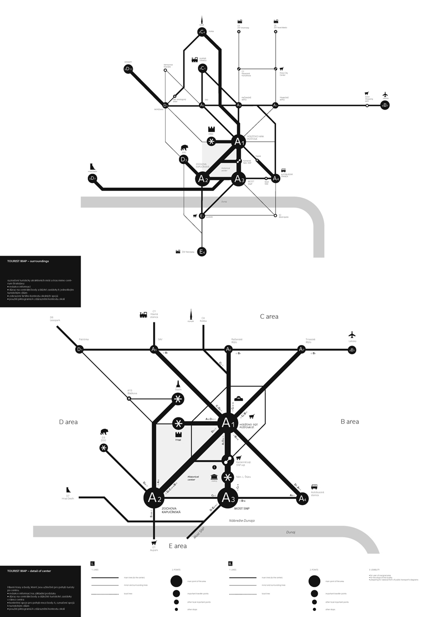
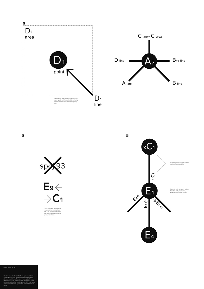
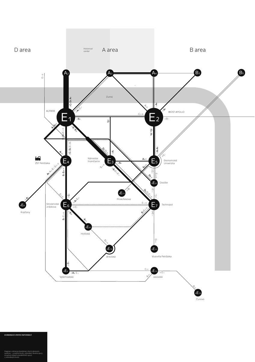
The public transportation system in Bratislava is neither transparent, nor logically conceived. To create a good layout, it is necessary to gather an enormous quantity of data to analyze the present situation, the road connections, and the major intersections. Dividing the city into five sectors, using a modular network and black‑and‑white graphics, Anna Ulahelová has managed to convincingly visualize the existing network of city connections. The result is a series of maps corresponding to users’ various needs. There is a map with the most important stops and connections leading to points of tourist interest; there are local maps providing important information for the various districts; a map of the fastest connections between remote parts of the city etc. This design is a splendid example of how to begin working with visual systems in a public space, to improve their accessibility and change users’ practices.